Technology Platform Use Cases Market Investors Request a Pilot
Florida canal at dusk
AI Infrastructure for Wildlife Risk

Protecting people and pets where wildlife and human habitats intersect.

AI-powered wildlife threat detection for communities, municipalities, resorts, and conservation organizations — starting with crocodiles and alligators in Florida's waterways.

15,000–0
Alligator-related public calls/year in FL alone
250K–0
Targetable high-risk sites statewide
76K–0
Stormwater ponds statewide in Florida (UF/IFAS)
Scroll
Built Within a Serious Ecosystem
NVIDIA Inception Member Edge AI & deep-tech startup program, 2026
NVIDIA Inception Program
Florida Venture Forum — Spotlight Company Selected 2026 · Florida's leading venture capital association
Florida Venture Forum Spotlight Company
Impact Electronic Solutions Hardware engineering partner — system architecture & requirements phase underway
Impact Electronic Solutions
20+ Granted Patents Held by founders from prior ventures
IP
01 See It In Action

From open water to alert, in seconds.

A conceptual walkthrough of how CrocAlarm's detection-to-alert workflow is designed to work. This is an illustration of the intended experience — not live footage, and not a real detection event.

An alligator just entered the canal. Today, nobody would know. CrocAlarm knows in seconds.
Concept Animation · Illustrative
No Threats Detected
Possible Contact — Assessing
Confirmed Threat — Alligator
Edge Sensor Network — Full Perimeter Coverage
Sonar contact acquired
Classifying — 46%
Classifying — 87%
Alligator — 99% confidence
Alert — Alligator Detected ~12m from protected edge · Community dock

This is a conceptual visualization of the intended workflow, built to communicate product direction — not a recording of a real deployment. Overlapping node coverage and confidence levels shown are illustrative targets, not field-validated results.

One node is enough to cover a typical dock or canal frontage.

Not every site needs a network. A single edge-mounted node is designed to cover the water directly in front of a private dock or residential frontage on its own.

Actual coverage geometry depends on final sonar hardware selection and site conditions — illustrative, not a guaranteed range specification.

02 The Problem

Human–crocodilian conflict is growing, and largely unmonitored.

No real-time detection system exists today. Current responses are static signage, intermittent patrols, and reaction after a sighting — not prevention.

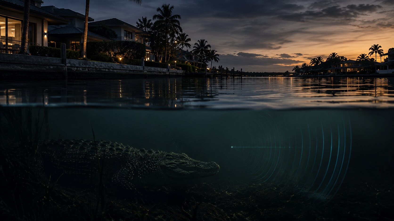
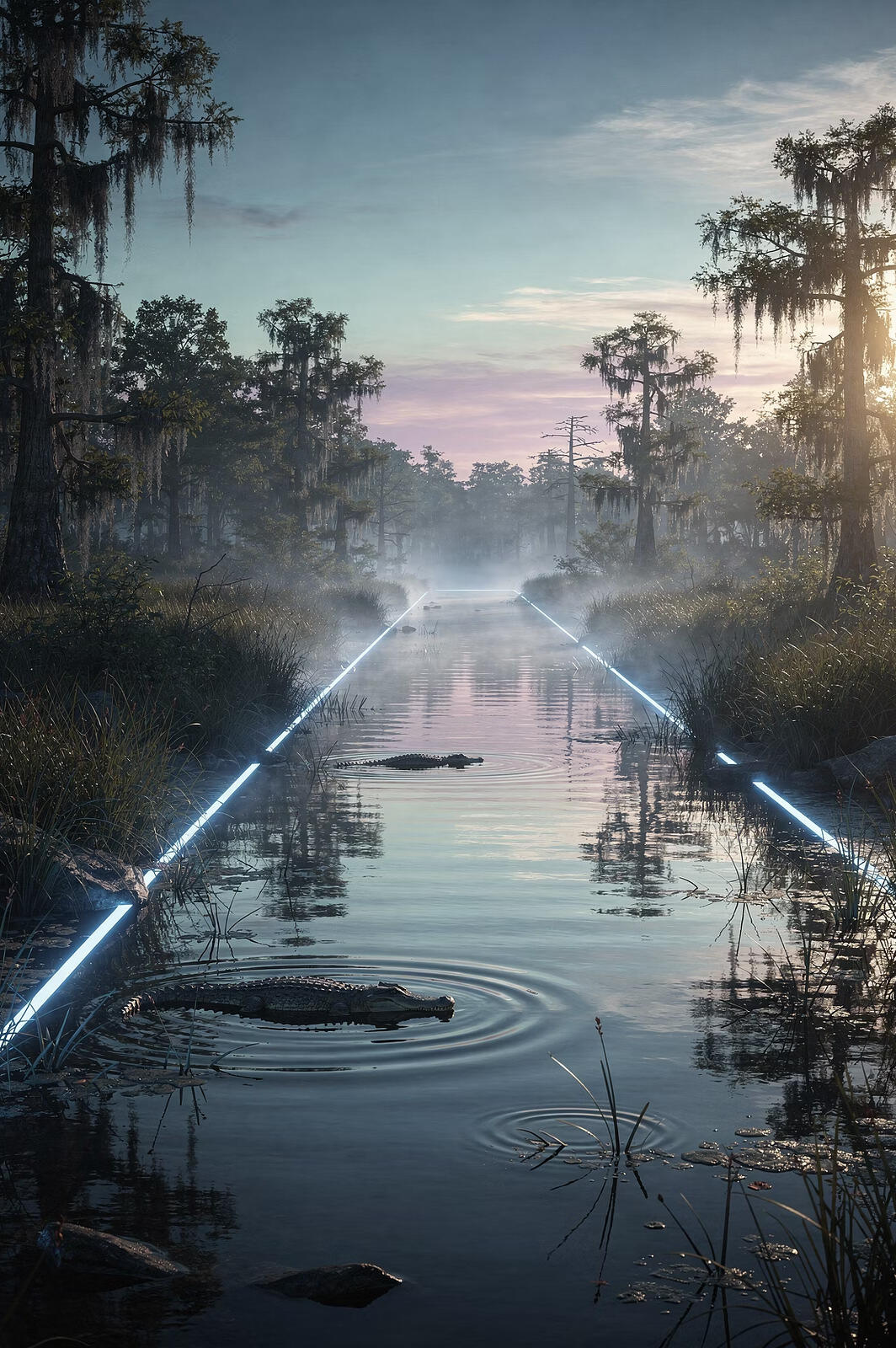
Crocodile beneath a Florida residential canal at dusk, sonar detection visualized

Normally invisible — this is what changes when something is finally watching.

The threat is rarely visible. That's exactly the problem.

Submerged, camouflaged, or masked by duckweed and algae, a crocodilian can sit meters from a dock, playground, or walking path without a single visual cue — day or night. It's why CrocAlarm is being built sonar-first: detection in the water column itself, independent of surface conditions, lighting, or vegetation cover.

Fatal Attacks

Hundreds of fatal crocodilian attacks are reported globally over time, with true totals likely undercounted due to inconsistent reporting across regions.

Pets & Companion Animals

Dogs and cats are frequent, quietly under-tracked victims. Florida wildlife agencies formally track human bites — not pet fatalities — so no official count exists at all. Anecdotal and regional reporting suggests the real number is far higher than anything publicly recorded, precisely because there's no requirement to report a pet lost to an alligator the way there is for a human attack. For many families, a pet is the first and most personal loss.

Livestock & Rural Losses

Crocodilians preying on cattle, sheep, and other livestock create substantial economic damage in rural and agricultural areas with limited monitoring infrastructure.

Rising Liability

HOAs, municipalities, resorts, and theme parks face increasing legal and insurance pressure whenever a wildlife incident occurs on their property.

15,000–0
Alligator-related public calls received annually by Florida wildlife agencies
0
Automated, scalable, real-time early-warning systems currently deployed at scale
76K–0
Stormwater ponds statewide in Florida alone (UF/IFAS estimate)

Despite relatively few fatal attacks, this volume of reports creates constant response costs, public fear, and political pressure for the agencies and property managers responsible for public safety.

03 Why Now

This category is forming now — and still has no defining company.

01

Rapid Waterfront Development

Human expansion increasingly brings communities into direct contact with protected aquatic wildlife habitats.

02

Climate Change Impacts

Shifting environmental conditions are pushing native animals into new zones, increasing human–wildlife conflict.

03

Rising Liability Standards

Cities, HOAs, and insurers face growing legal and financial pressure to protect residents from wildlife threats.

04

Edge AI Advances

Recent breakthroughs in AI deployed at the network edge make continuous, real-time wildlife monitoring technically and economically viable for the first time.

05

Market Gap

No established incumbent owns wildlife risk intelligence today — leaving the category wide open.

Historical Parallel

In safety-critical environments, monitoring always shifts from optional to required.

Cybersecurity · Enterprise IT

Most companies are never breached in a given year, and budgets aren't sized to that base rate — they're sized to the catastrophic financial, legal, and reputational cost when it happens once. Wildlife risk follows the same logic.

ShotSpotter · Cities

Acoustic gunshot detection evolved from an optional add-on to a standard urban safety tool.

Flood Sensors · Municipal Infrastructure

Early-warning flood detection became indispensable for disaster preparedness.

Fire Detection Networks · Wildland-Urban Interface

Advanced wildfire monitoring is now a standard requirement in at-risk communities.

04 Technology

A sonar-first approach to a biological detection problem.

CrocAlarm is built around imaging sonar — chosen because it works where cameras fail: murky water, darkness, heavy vegetation, and zero-visibility conditions.

Autonomous Aquatic Sensing
Sonar-first, active & passive
Edge AI Processing
On-device signal analysis
Instant Alerts
Beacon, SMS, dashboard
Data Platform
Longitudinal risk modeling
Where We Are Today
  • A structured system-architecture and requirements-definition phase is underway with an experienced hardware engineering partner.
  • Candidate imaging sonar platforms are under formal evaluation, prioritized on identifiable target range — the distance at which the system can distinguish a crocodilian from a turtle, fish, or floating log — not headline maximum range.
  • The near-term deliverable is a supervised, dock-mounted data-collection prototype: sonar as the primary sensor, camera as a supporting validation and labeling tool.
  • Field deployment and real-world detection validation have not yet occurred. We believe an infrastructure company earns trust by being precise about its stage.
  • Technical validation currently runs through our hardware engineering partner and direct sonar-manufacturer relationships. We're actively expanding our advisory bench to add dedicated aquatic-acoustics expertise as the program moves into field trials.
Where We're Going

From one data-collection node to an always-on perimeter network.

Our roadmap points toward autonomous, solar-powered sonar nodes deployed along the human-occupied edges of a water body — docks, seawalls, canal banks, and swim zones — rather than a single sensor in open water. Coverage is designed from the edges inward, aimed at the zones people actually enter, so the system can protect the perimeter people occupy rather than attempt to observe an entire water body at once.

That data — proprietary, real-world, and continuously collected — is what will ultimately train the detection and classification models at the core of WildlifeOS.

05 Built Responsibly

Built to protect people — without harming wildlife.

Non-Invasive By Design

Passive-first sensing with low-power active sonar. Detection informs response — the system is not designed to contact, deter aggressively, or harm the animal. Wildlife-welfare review is a Phase 1 requirement, not an afterthought.

We Won't Invent Accuracy Numbers

Our field trials are explicitly designed to measure real-world false-positive rates before any commercial accuracy claim is made. We'll publish validated figures when we have them — not before.

No Cameras Pointed At Your Backyard

CrocAlarm is sonar-first. Nodes listen to the water column, not the shoreline. No facial recognition, no continuous video of private property — event-based data retention only.

Detection Ends In Coexistence

Alerts are designed to route to community managers and, where appropriate, licensed responders under established nuisance-wildlife protocols. The goal is fewer surprise encounters — for people and for the animal.

Wildlife-welfare review in Phase 1 Event-based data retention No optical surveillance of private property Designed for FWC protocol alignment
06 Product Experience

An illustrative look at the WildlifeOS dashboard.

This is a conceptual prototype of the operator experience we are designing — not a live system. It shows how detection, alerts, and incident data would come together for a community or agency operator.

WILDLIFEOS OPERATOR CONSOLE — ILLUSTRATIVE PROTOTYPE
Concept
Live · updated 4s ago
CrocAlarm · Crocodilians
SharkAlarm™ · SharksComing Soon
Multi-Species · Platform-WideRoadmap
Live Map
Detection Timeline
Sensor Health
Incident Queue
Sonar View
Analytics
4
Active Nodes
1
Alerts Today
247
Detections This Month
99.2%
Uptime
Deployment Map
×
Status
Species
Confidence
Last update
View in Incident Queue →
Active Alert Node Online Needs Attention
Weather & Conditions
84°F
Water Temp
Dusk
Light
Clear
Conditions
Node Status
Canal Edge – Node 3Online · 6s ago
Dock Node – Node 7Degraded · 14m ago
Retention Pond – Node 1Online · 3s ago
West Canal – Node 12Online · 9s ago
Recent Detection Events
06:42Windward IslesSonar contact classified as American Alligator — Canal Edge Node 392% conf.
05:58Windward IslesContact classified as turtle, no alert issued88% conf.
04:15Pelican BayUnresolved contact — flagged for human review54% conf.
Yest.Windward IslesSonar contact classified as American Alligator — Dock Node 795% conf.
Yest.Pelican BayContact classified as wading bird, no alert issued81% conf.
2d agoWindward IslesSonar contact classified as American Alligator — West Canal Node 1297% conf.
Node Health
Sonar TransducerNominal
Compute ModuleNominal
Comms LinkConnected
Battery / Solar68% charge
AI Confidence — Current Contact
91%
Classification confidence
Fleet Overview — All Nodes
Canal Edge – Node 3Nominal · 91% battery
Dock Node – Node 7Signal Degraded · 68% battery
Retention Pond – Node 1Nominal · 84% battery
West Canal – Node 12Nominal · 97% battery
Incident Queue
All Open Resolved
HIGHWindward IslesAlligator confirmed near community dock — response initiatedAcknowledge6 min ago
MEDIUMPelican BayUnclassified contact near canal edge — under reviewAcknowledge2 hr ago
RESOLVEDWindward IslesFalse positive cleared — floating debrisYesterday
RESOLVEDSt. Pete RiverwalkAlligator moved beyond monitored perimeter2 days ago
Sonar Return — Current Contact
Contact · 91% conf.
Camera Validation View

In the target architecture, camera imagery is used to validate sonar contacts and improve dataset labeling — a supporting sensor, not the primary detector.

Sync statusSynced
Frame rate15 fps
247
Total Detections (30d)
6.1%
False Positive Rate
1.8s
Avg. Detection-to-Alert
3
Sites Monitored
Detections by Week (Illustrative)
Contact Classification Breakdown
American Alligator61%
Turtle / Non-Threat24%
Unresolved / Under Review9%
False Positive (debris, etc.)6%
07 Concept Demo

Simulate a detection event.

An illustrative walkthrough of the detection-to-response pipeline the platform is being designed around.

Adjust water condition and distance — they influence the detection confidence below.

Time Since First Contact 0.00s
Sonar Detects Movement

Contact registers on the sonar return.

Edge AI Classification

On-device model evaluates target shape and motion.

Confidence Increases

Successive returns refine the classification confidence.

Threat Assessed

Position, trajectory, and proximity to the edge are evaluated.

Alert Issued

Beacon, SMS, and dashboard notification dispatched.

Incident Created

Event logged to the incident queue with full sensor context.

Response Initiated

Community or agency operator is notified for follow-up.

9:41
🐊
CrocAlarmnow
Alert dispatched
Waiting for simulation to run.
08 Hardware

In active engineering development — not yet a finished product.

These renderings reflect real, ongoing work. A formal system architecture and requirements engagement with our hardware engineering partner is underway now — final specifications for the sonar platform, enclosure, and power system are still being locked down.

Imaging sonar is not cheap today, and we're not pretending otherwise. We're proving detection performance on best-available hardware first, then moving sourcing to OEM manufacturing partnerships to bring per-unit cost down for HOA- and municipal-scale deployment — engineered first for proof, priced for scale as we grow.

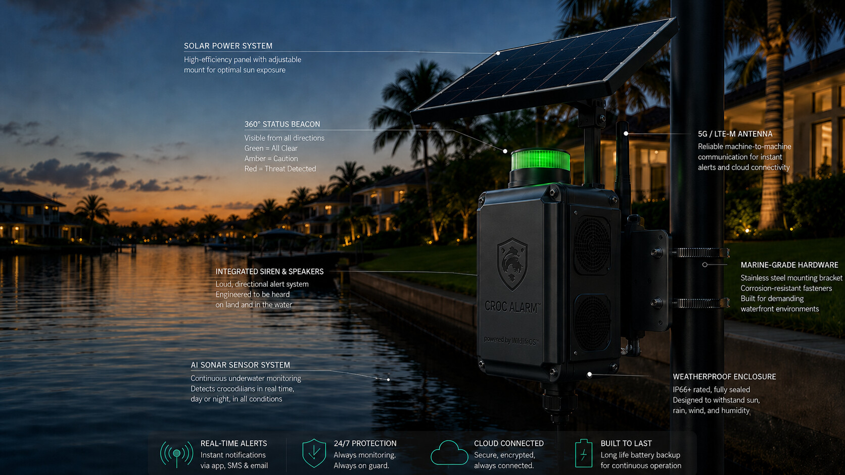
CrocAlarm edge-mounted sonar node concept rendering, annotated

Concept rendering of the edge-mounted node architecture, reflecting engineering work underway now. Components and specifications are still being validated with our hardware engineering partner.

Target Architecture

Solar-powered nodes, deployed at the edge.

Rather than a single sensor placed in open water, the target architecture places autonomous, solar-powered sonar units along the shoreline — docks, seawalls, and canal banks — each aimed outward toward the zone people actually occupy.

This edge-first approach is designed for higher reliability in continuous outdoor operation, and maps naturally to how protected area — and pricing — scale per site.

Imaging Sonar

Primary sensing element. Solid-state multibeam under evaluation for identifiable target range in low-visibility water.

Solar & Battery

Power architecture sized for continuous, unattended outdoor operation between service intervals.

Validation Camera

Supporting sensor used to validate sonar contacts and accelerate dataset labeling — not the primary detector.

Ruggedized Enclosure

Marine-rated housing engineered for continuous exposure to heat, humidity, and biofouling.

Edge-mounted deployment topology — multiple fixed-position nodes aimed outward from docks, seawalls, and canal banks — is the coverage model currently being evaluated, in place of a single mid-water sensor.

09 Platform

CrocAlarm is the first application. WildlifeOS is the company.

The architecture is designed to generalize across species and geographies using the same sensing, modeling, and compliance stack.

01

Initial Wedge — Crocodiles & Alligators

Focused on Florida communities: HOAs, golf courses, canals, retention lakes, and municipal waterfront assets.

02

Platform Expansion — SharkAlarm, Snakes, Large Mammals

SharkAlarm is the next planned product, extending the same edge AI classification, alerting, and data platform — not the same sensor — to new species, sensor modalities (computer vision, thermal, acoustic), and geographies over time.

03

Category Ownership

WildlifeOS aims to become the system of record for wildlife risk — the intelligence layer institutions rely on for safety, liability, and compliance.

“WildlifeOS is not a device company — it is infrastructure for real-world AI.”

Deployment → Data
Data → AI Models
AI → Compliance
Compliance → Mandate
Mandate → Standard
10 Use Cases

Built for every environment where people and water meet wildlife.

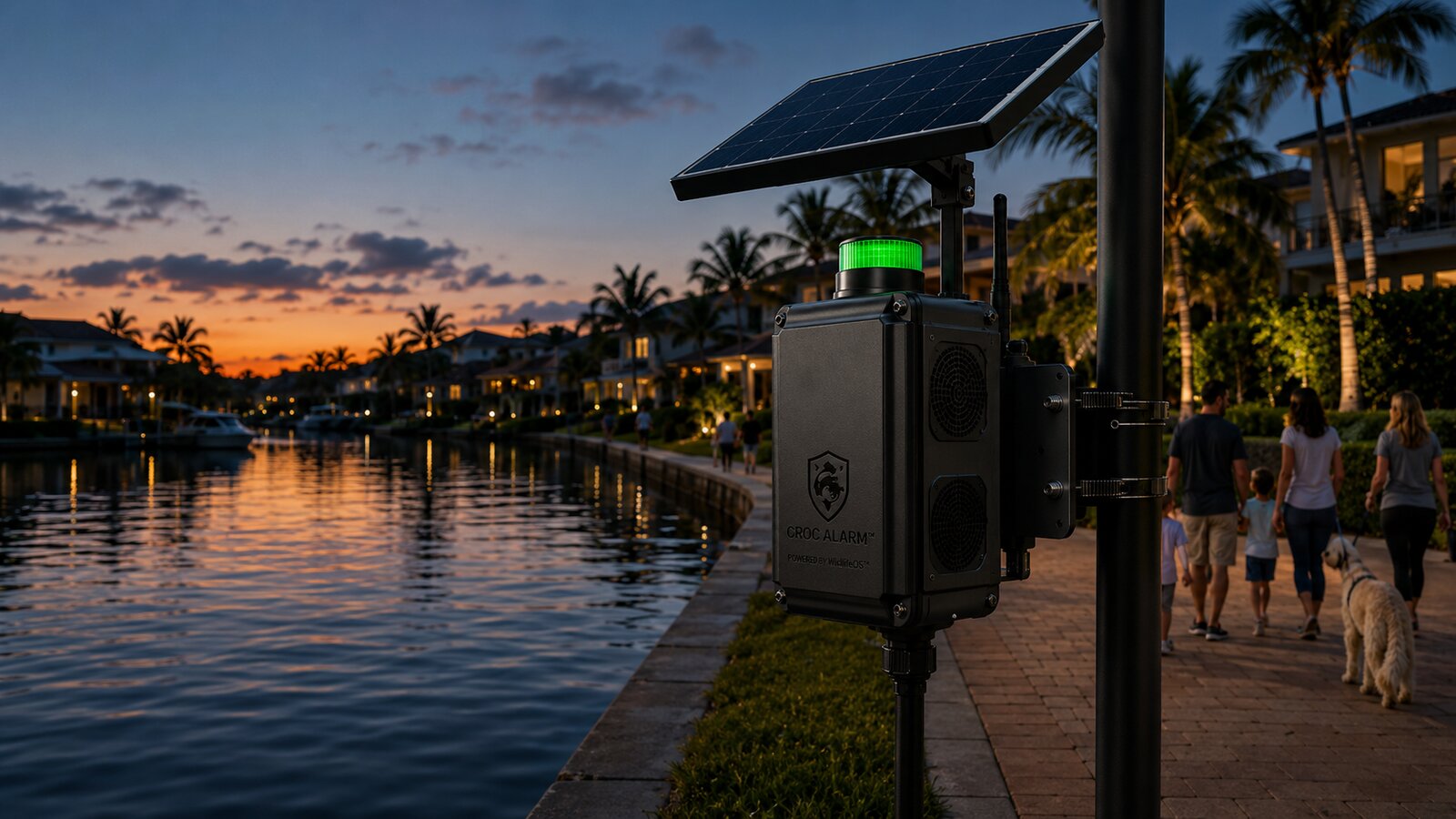
CrocAlarm node mounted along a residential canal walkway

HOAs & Residential Communities

Canals, retention ponds, and community lakes sit adjacent to homes, walkways, and docks across Florida. Boards and property managers currently rely on signage and resident reports — and for many residents, the water's edge is where a dog is walked every day.

  • Continuous monitoring of community waterways without added staffing
  • Documented incident history to support liability and insurance conversations
  • Resident-facing alerts alongside board and management dashboards
  • Protection that covers pets, not just people — dogs and cats are frequent, largely untracked victims near residential water

Florida HOA and property-management channels are the primary go-to-market path for initial deployments, focused on the highest-liability, highest-visibility communities.

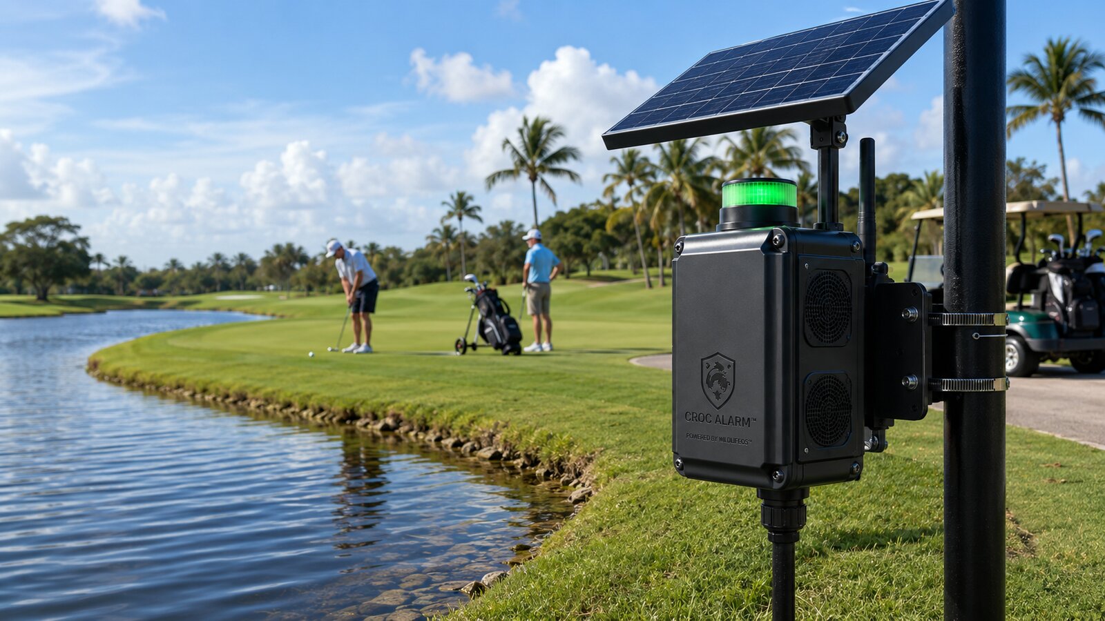
CrocAlarm node mounted beside a golf course water hazard

Golf Courses

Water hazards, cart paths, and tee boxes place golfers and staff repeatedly near crocodilian habitat throughout a round.

  • Edge-mounted coverage along cart paths and water-adjacent holes
  • Reduced operational disruption compared to manual course checks
  • Supports duty-of-care documentation for course operators

Coverage is designed around protected linear footage of course frontage — not total pond area — matching how courses actually experience risk.

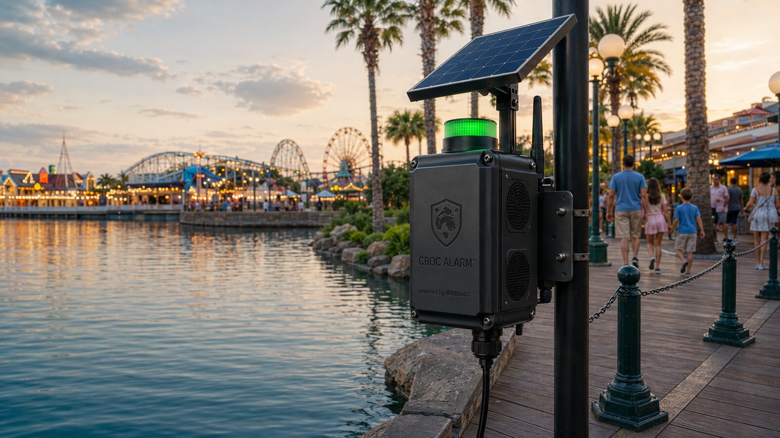
CrocAlarm node mounted along a resort waterfront promenade at dusk

Resorts & Parks

Guest-facing waterfront amenities carry high visibility and high reputational stakes when an incident occurs.

  • Real-time alerts to on-site safety and operations staff
  • Discreet monitoring that does not disrupt the guest experience
  • Incident logging to support insurance and regulatory requirements

Marinas and resort waterways are included in the broader Florida wedge alongside HOAs and municipal sites.

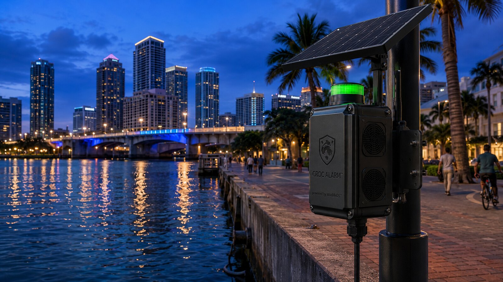
CrocAlarm node mounted along a municipal riverwalk

Municipalities

Cities and counties field thousands of public wildlife calls annually with limited tools to triage genuine risk from routine sightings.

  • Structured data to prioritize wildlife agency response
  • Audit trail supporting compliance and public-safety reporting
  • A path toward monitoring standards as insurance and legal expectations evolve

Florida wildlife agencies alone receive 15,000–20,000 alligator-related public calls every year.

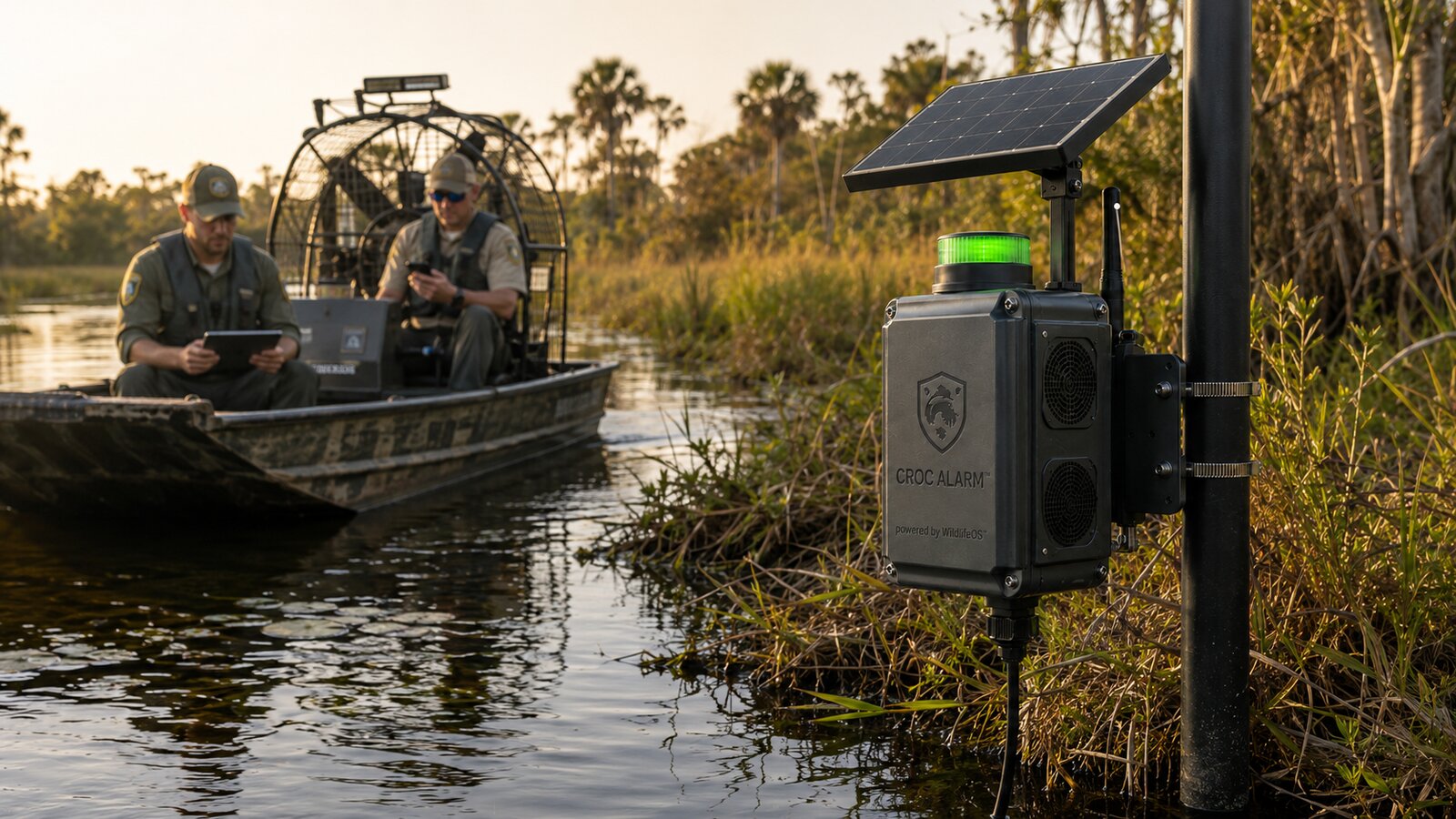
Wildlife officers on an airboat near a CrocAlarm node in a Florida wetland

Agencies & Nuisance Alligator Trappers

Florida's Statewide Nuisance Alligator Program (FWC) dispatches independently contracted trappers to locate and remove animals reported through the Nuisance Alligator Hotline — roughly 15,000–20,000 complaints a year statewide. A trapper is typically dispatched to a general location with no way to confirm whether the animal is still there, still visible, or long gone.

  • Real-time location data for a dispatched trapper, instead of searching a pond or canal blind
  • Less wasted time per call — trappers are largely compensated per animal, not per hour, so faster location has a direct upside for them, not just the agency
  • Longitudinal behavioral and population data that supports research and habitat-management decisions over time

CrocAlarm has no authority to capture or remove an animal — under Florida law, that stays with FWC-contracted trappers. The goal is to make an already state-mandated job faster and safer once a site is monitored, not to replace the people doing it.

11 Pricing

Priced per site, not per headache.

Indicative pricing for early deployments — final packaging is confirmed during pilot scoping.

Hardware

Node hardware priced per unit, sized to your site's frontage — quoted after a short site walkthrough.

Monitoring Subscription

Indicative $100–$150 per device, per month, for real-time detection, alerts, analytics, and OTA updates.

Enterprise & Municipal

Multi-year bundled agreements ($25K–$150K+ annually) for larger portfolios, HOAs, and municipal contracts, including SLAs and integration support.

Pricing shown is indicative and will be finalized through pilot partnerships. Request a pilot for a site-specific quote.

12 Market Opportunity

A multi-billion to $100B+ wildlife risk infrastructure opportunity.

Wildlife risk is one of the largest unstructured risk categories in the physical world — and it has no system of record.

Layer 1 — Florida Wedge

~250K–400K targetable sites (canals, HOAs, waterfront assets). $250M–$400M hardware TAM. $300M–$720M SaaS ARR potential.

Layer 2 — Global Predator Expansion

Crocodiles & alligators: $2B–$5B+ annual impact. Sharks: $500M–$2B+ annual impact, driven by liability, tourism disruption, and insurance pressure.

Layer 3 — WildlifeOS Platform

Multi-species expansion across snakes, large mammals, and agriculture. Broader wildlife-risk category: $50B–$200B+ annual economic impact.

Florida is the proving ground, not the ceiling. Crocodilians are documented in 87 countries across Africa, Asia, the Americas, and Australia, with an estimated 1,000 fatal attacks occurring worldwide every year (crocattack.org). Sonar is the right first sensor for Florida's murky canals — computer vision, thermal, and acoustic sensing extend the same edge AI and data platform to sharks, large mammals, and other species as WildlifeOS expands.

13 Validation Roadmap

From prototype to infrastructure.

PHASE 1

Controlled Sonar Data Collection

Tank and controlled environments used to capture labeled crocodilian movement signatures.

PHASE 2

Signature Dataset & Model Training

Build the initial labeled sonar dataset and train early detection and classification models.

PHASE 3

Early Field Trials (Florida)

Deploy in 5–10 controlled real environments to validate detection accuracy and false-positive rates.

PHASE 4

Pilot Deployments (HOAs / Cities)

20–50 real-world deployments to generate continuous dataset and customer validation.

PHASE 5

Compliance & Insurance Layer

Generate logs, reporting, and audit trails; begin positioning for underwriting and mandates.

14 Team

Deep tech and commercial scale, paired by design.

Full Team & Advisors
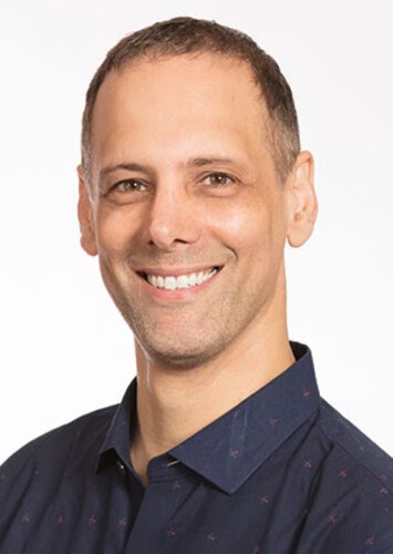
Rodolfo Saccoman
Rodolfo Saccoman, MBA
Co-Founder / CEO / CGO

MBA, Cornell University / University of Miami. Serial founder with prior exits and $20M+ raised. Leads commercialization, capital strategy, and the investor narrative.

Dr. Noel Elman
Dr. Noel Elman, PhD
Co-Founder / Chief Scientist

PhD: Tel Aviv University / MIT / Cornell. 20+ years leading federally funded programs (NSF, USDA, NOAA). Owns deep tech and R&D.

Adam Benzion
Adam Benzion
Edge AI & Hardware Advisor

Director at Qualcomm. Co-founder/CEO of Hackster.io (acquired by Avnet). Early investor/CXO at Edge Impulse (acquired by Qualcomm).

15 Get Involved

Ready to bring real-time wildlife detection to your community?

Whether you manage a community, a course, a resort, or a portfolio of waterfront assets — or you're an investor exploring the category — let's talk.